UN
12 Marston Mead
£ 126,000
Description
We don't have a Description for this property.
- Bedrooms
- 2
- Bathrooms
- 0
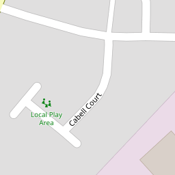

Leaflet © OpenStreetMap contributors
The heatmap indicates the level of crime in the area. The color of the heatmap indicates the crime severity and recency.
Metrics Year-on-Year
- Average area value
- 356,500.00 £Decreased by 7.90 %
- Average area rental value
- 795.00 £/moDecreased by 21.44 %
- Est rental Yield
- 2.68 %Decreased by 14.65 %
- Crime Rate
- 2.00 %Unchanged by 0.00 %
from 387,061.00 £
from 1,012.00 £/mo
from 3.14 %
from 2.00 %
Nearby Schools
| Name | Type | Ofsted | Distance |
|---|---|---|---|
| Critchill Special School | Academy Special Converter | 1.20 KM | |
| Trinity Church Of England First School | Voluntary Controlled School | Good | 1.20 KM |
| Oakfield Academy | Academy Converter | Requires improvement | 1.21 KM |
| Wessex Lodge School | Other Independent Special School | Good | 1.30 KM |
| Avanti Park School | Free Schools | 1.33 KM |
Images
Nearby Streets
| Name | Average Price | Average Sqft | Distance |
|---|---|---|---|
| Marston Road | £ 785,000 | 0 | 0.00 KM |
| Whitemill Lane | £ 0 | 0 | 0.00 KM |
| Oakfield Road | £ 0 | 0 | 0.00 KM |
| St Aldhelm's Close | £ 0 | 0 | 0.00 KM |
| Mount Pleasant | £ 450,000 | 0 | 0.00 KM |
Nearby Transport
| Name | NLC | TLC | Distance |
|---|---|---|---|
| Frome | 5707 | FRO | 2.67 KM |
Nearby Listings
| Address | Price | Type | Score | Distance |
|---|---|---|---|---|
| Marston Mead, Frome | £ 300,000 | BUY | 7 / 10 | 0.01 KM |
| Marston Close, Frome | £ 325,000 | BUY | Unknown | 0.08 KM |
| Cranmore View, Frome, Somerset, BA11 | £ 287,500 | BUY | 6 / 10 | 0.09 KM |
| Cooks Lane, West Cranmore, Shepton Mallet, Somerset, BA4 | £ 275,000 | BUY | 6 / 10 | 0.12 KM |
| Courts Barton, Frome, BA11 4QA | £ 240,000 | BUY | 5 / 10 | 0.18 KM |
Nearby Properties
| Address | Price | Distance |
|---|---|---|
| 6 Marston Mead | £ 155,000 | 0.00 KM |
| 12 Marston Mead | £ 126,000 | 0.00 KM |
| 1 Marston Mead | £ 236,500 | 0.00 KM |
| Grove House | £ 350,000 | 0.00 KM |
| 22 Marston Mead | £ 125,000 | 0.00 KM |